
Historical timeline
Major Events That Shaped Our Understanding
From ancient cataclysms to modern close calls, these events reveal the forces that shaped life on Earth and the technologies now used to monitor them.
Near-Earth objects
Asteroid Risk in Numbers
Most extinction-scale objects are cataloged, but smaller regional-risk objects remain harder to find. Early detection is the key variable.
Why warning time matters
Deflection is easier when a hazard is discovered years or decades in advance. A small velocity change applied early can move the object thousands of kilometers away from a future impact corridor.
- Survey telescopes discover and refine orbits.
- Radar and follow-up observations reduce uncertainty.
- Kinetic impactors and gravity tractors need lead time.
Threat categories
Six Existential Dangers
These forces can reshape civilization, destroy infrastructure, or create global environmental stress.
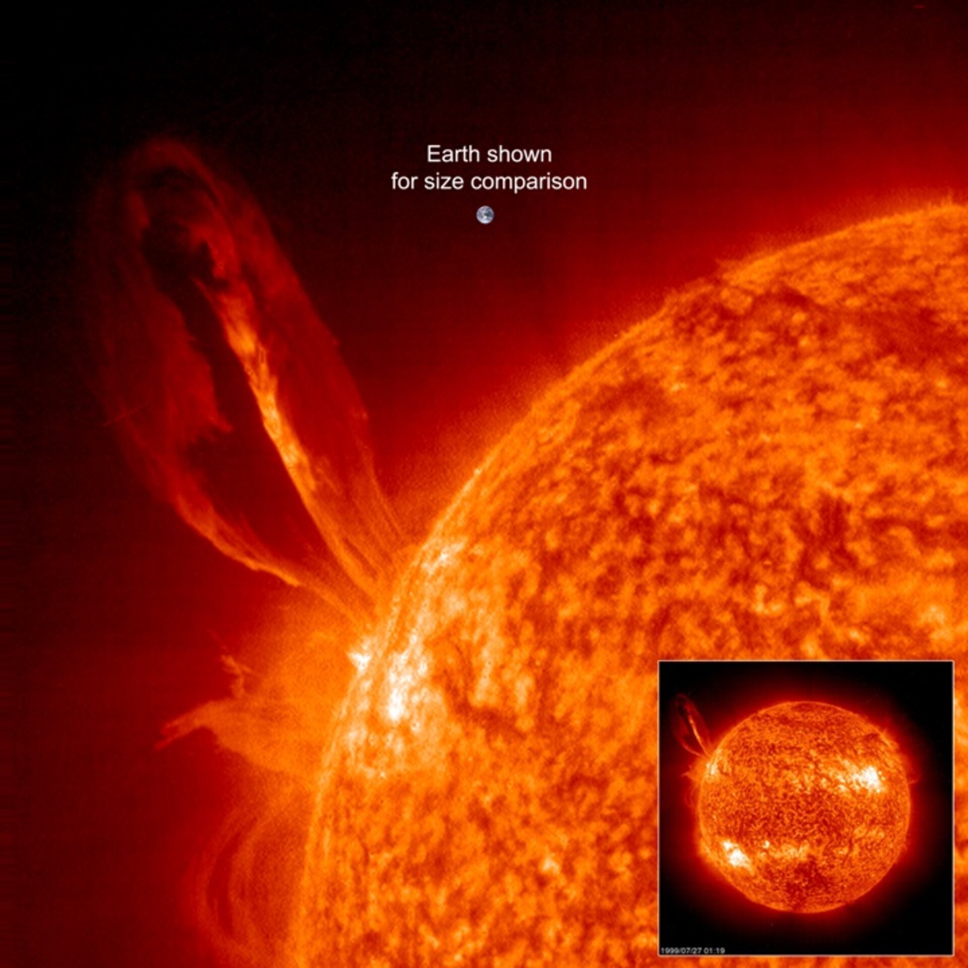
Potential damage: $0.6T to $2.6T+
The Invisible Threat from Our Star
Coronal mass ejections can hurl magnetized plasma toward Earth at millions of kilometers per hour. A Carrington-class event today could damage transformers, satellites, GPS, aviation communications, and internet infrastructure.
Power grids
Geomagnetically induced currents can overheat high-voltage transformers.
Satellites
Radiation can damage electronics, shorten orbital life, and disrupt navigation.
Warnings
L1 spacecraft can provide roughly 15 to 60 minutes of warning.
Preparation
Grid hardening, GIC blockers, and backup communications reduce vulnerability.
Planetary defense proof
DART Showed Deflection Can Work
NASA's Double Asteroid Redirection Test struck Dimorphos in 2022 and changed its orbit by 32 minutes, far above the 73-second mission success threshold.
Kinetic impact
A spacecraft transfers momentum by striking the asteroid at high speed.
DemonstratedFollow-up science
ESA's Hera mission will study the impact crater and asteroid system dynamics.
Arrives 2026Lead time
Deflection works best when a hazard is found years in advance.
Goal: 10+ yearsSeismic and ocean risk
Earthquakes, Tsunamis, and Supervolcanoes
These risks cannot be prevented outright, but monitoring, warning networks, resilient design, and evacuation planning can sharply reduce casualties.
Earthquake early warning
P-wave detection can provide seconds to more than a minute of warning before destructive S-waves arrive.
5-90 secondsTsunami detection
DART buoys, tide gauges, and seismic networks can provide warnings from minutes to hours depending on distance.
Ocean basin scaleSupervolcano monitoring
Ground deformation, gas emissions, seismic swarms, and thermal anomalies help track volcanic unrest.
Low probability, high impactRisk geography
Global Threat Hotspots
A simplified static risk map showing broad regions associated with earthquakes, volcanoes, tsunamis, solar vulnerability, and asteroid observation networks.
Yellowstone
Ring of Fire
Indian Ocean
High latitude grids
NEO surveys
Interpretation
This map is schematic, not a live hazard model. It highlights the logic of defense: monitor globally, issue warnings quickly, harden infrastructure, and coordinate internationally.
- Space threats require global observatories and impact-response governance.
- Seismic and tsunami risk concentrates near subduction zones.
- Solar storm risk is strongest for power grids at higher magnetic latitudes.
Defense systems
Global Defense and Resilience Strategies
The strongest response is layered: detect early, model accurately, warn fast, harden critical systems, and train populations.